🌉 If you have ever watched a viral clip of a truck losing its roof to a low railroad bridge, you have seen the exact problem a Japanese company now wants to solve.
In the United States, vehicles slam into bridges roughly 15,000 times a year, according to federal traffic-safety figures. Now Dynamic Map Platform, a Tokyo firm better known for the digital maps that guide self-driving cars, has started selling North American road authorities a way to map every overpass and tunnel down to the inch.
Why American bridges keep getting hit
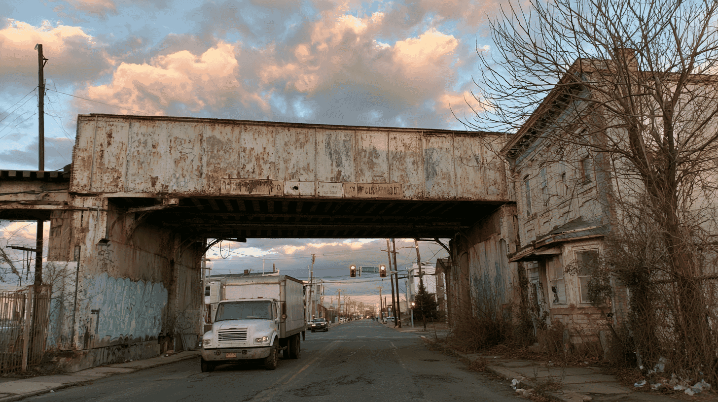
Bridge strikes are one of those infrastructure problems that look almost comic until you check the numbers. The most famous case is the "Can Opener" in Durham, North Carolina, a 1940 railroad trestle with just 11 feet 8 inches of clearance. Since a camera started rolling in 2008 it has logged more than 180 strikes by trucks, buses and RVs. Raising it eight inches in October 2019, to 12 feet 4 inches, cut state-recorded crashes from about 8.4 a year to 3.6, but did not stop them. The crashes, caught on a dedicated camera, have become a long-running internet spectacle.
The bigger picture is less funny. The federal government recommends at least 14 feet of clearance on public roads, and some states build to 16 feet on interstates. But there were no minimum-clearance rules when this trestle went up in 1940, and thousands of older, lower structures are still in service. And the clearance under each one is not fixed. Every time a road is repaved, fresh asphalt can lift the surface by a couple of inches, shaving the clearance above it. A bridge that was safe to pass under last year may not be this year.
That is why U.S. transportation departments are under growing pressure to keep precise, current height records. The federal government is in the middle of switching its bridge-data rules to a new standard called SNBI (Specifications for the National Bridge Inventory), which pushes states toward more detailed, structured information. Measuring all of it the old way, by sending survey crews to close lanes and shoot each bridge by hand, is slow, costly and risky.
Source: Dynamic Map Platform Co., Ltd. press release
A company born from Japan's self-driving push
Dynamic Map Platform, or DMP, has a very Japanese origin story.
It began in 2016 as a government project. Under a Cabinet Office innovation program aimed at autonomous driving, a group of mapping and surveying firms, Mitsubishi Electric among them, set out to build the ultra-precise 3D road maps that self-driving cars need. These "HD maps" record lane lines, road curvature, sign positions and the exact shape of the road, accurate to the centimeter, giving a car's sensors a reference to check themselves against.
A year later the project turned into a real company, backed by the government-linked investment fund INCJ and ten Japanese automakers, from Toyota and Honda to Suzuki and Hino. It worked like an industry-wide utility: instead of each automaker mapping Japan on its own, they pooled the effort. DMP's maps later went into Nissan's hands-off ProPilot 2.0 highway system and Honda's Sensing 360+.
The North American piece arrived in 2019, when DMP bought a U.S. mapping company that General Motors had backed, giving it a base in Livonia, Michigan, and crews already driving American roads. By the time DMP listed on the Tokyo Stock Exchange's Growth market in March 2025, more than two-thirds of its revenue came from outside Japan, with GM as its single biggest customer.
A second life for self-driving data
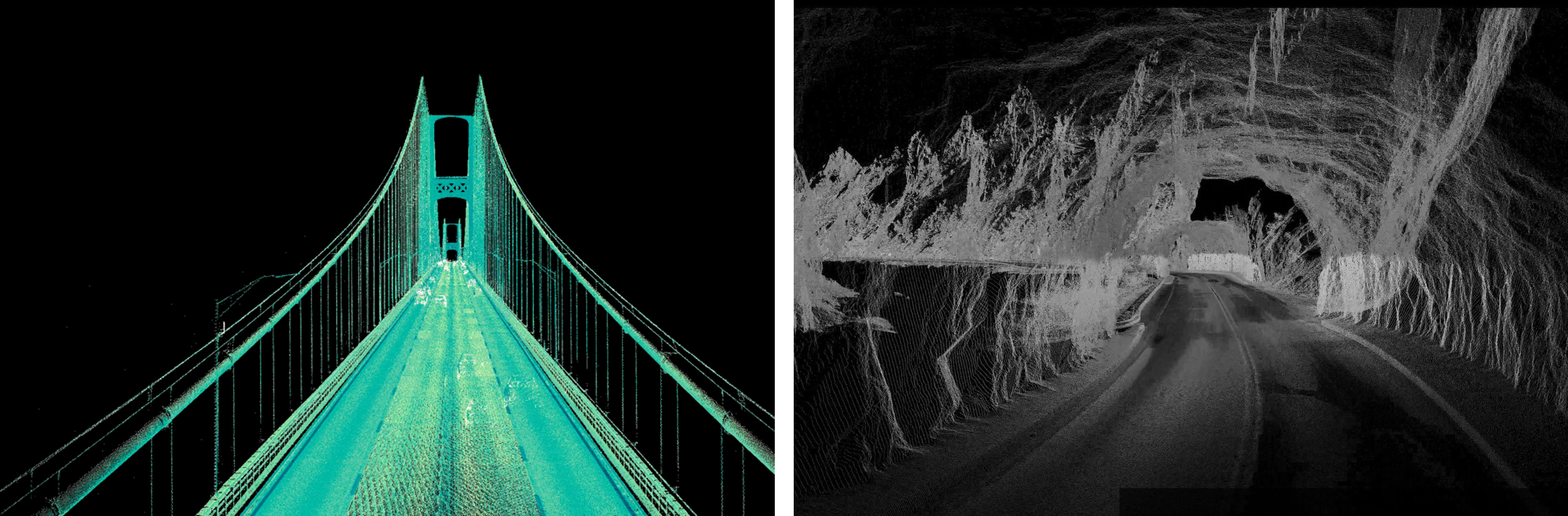
Here is the clever part. To map roads for autonomous cars, DMP had already driven much of North America with survey vehicles carrying a "mobile mapping system," or MMS: a roof rack of lasers, cameras and positioning gear that captures a dense 3D scan of everything around the vehicle at normal driving speed, without closing a single lane.
Those scans already contain the bridges. DMP says it holds high-precision 3D data for about 1.5 million kilometers of road across 48 U.S. states and all of Canada, including roughly 250,000 bridges and elevated structures and about 2,000 tunnels. The new service mines that existing trove for clearance heights and packages it for road authorities, in a format compatible with the SNBI standard and with the GIS and 3D platforms agencies already run.
In other words, DMP's pitch is not that it will go measure America's bridges, but that it already has, as a byproduct of mapping the country for self-driving cars, and can refresh the data the same way.
America already collects bridge data, so why Japan?
The U.S. is not short of bridge information. The Federal Highway Administration runs the National Bridge Inventory, a public database covering every significant bridge in the country, and a small industry of apps such as Low Clearance Map, plus the truck-routing layers inside HERE and TomTom, already steers truckers and RV drivers around low overpasses using clearance data pulled from public records and driver reports.
Those serve different needs, though. The federal inventory is built mainly for inspections and condition ratings, not precise, frequently refreshed clearance geometry. The routing apps are aimed at drivers trying to dodge a crash, not at the agencies responsible for the asset itself. Specialized survey firms can produce survey-grade mobile-LiDAR scans of a bridge, but usually one project at a time.
DMP's pitch sits in that gap: continent-scale 3D data, already collected, that the transportation departments themselves can fold into their asset-management systems. Whether U.S. agencies want a foreign vendor in that role, and how its pricing stacks up against domestic surveyors, will decide how far the service spreads. DMP is still a young, loss-making company chasing a market it has only just entered.
What it says about Japan's tech exports
Japan spent years and public money building a shared, nationwide HD-mapping capability to keep its carmakers competitive in self-driving tech. That investment is now being resold abroad in a form no one originally designed it for: not as a car product, but as infrastructure data for foreign governments.
DMP has said the same approach could eventually come home, applied to Japan's own aging bridges and tunnels, where maintenance budgets and inspection staff are stretched thin. A dataset built to teach cars how to drive themselves may end up helping people keep their bridges standing, on both sides of the Pacific.
Bridge strikes happen anywhere there are trucks and old overpasses. How does your country keep track of which bridges its vehicles can safely pass under, and who pays to keep that information current?









Global Discussion
3 comments