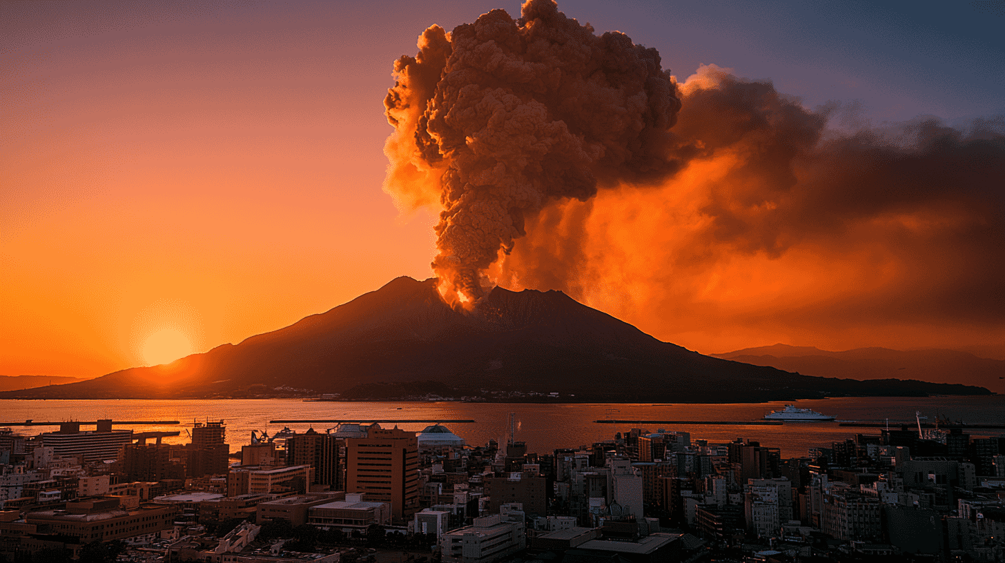
🌋 Two of Japan's most photogenic volcanoes are restless at the same time, and both of them sit inside popular tourist regions.
In the south, Sakurajima just produced its first pyroclastic flow in roughly eight years. In the north, Mount Meakan in Hokkaido has been shaken by more than 200 volcanic earthquakes in a single day. Neither is a reason to cancel a trip to Japan. But "everything's probably fine" is not a plan, especially in a country where some of the most beautiful viewpoints sit on the slopes of working volcanoes.
Here's what just happened, what's affected near each volcano, and where to actually check the situation before you go.
What just happened at Sakurajima
Sakurajima is the volcano that hangs over Kagoshima City in southern Kyushu. About 600,000 people live within sight of it, and the ferry from the city center docks at its base in 15 minutes. Daily ash dustings are normal here, locals check the wind forecast the way other cities check pollen.
What is not normal is what happened on May 8, 2026, at 4:15 p.m. The Minamidake summit crater produced an explosive eruption that sent an ash plume 3,500 meters above the crater rim. Ballistic rocks landed as far as the fifth station, around 1,000 meters from the vent. And, on closer analysis the next day, the Kagoshima Local Meteorological Observatory confirmed something Sakurajima hadn't done since June 2018: a small pyroclastic flow, a fast-moving avalanche of hot gas, ash, and rock, traveled about 600 meters down the southeast flank.
Pyroclastic flows are the deadliest hazard a volcano like Sakurajima can produce. This one was small. It stayed inside the existing exclusion zone. But it broke an eight-year quiet streak, which is why it matters.
The mountain has also resumed inflating. On May 10, tilt and strain sensors on the island picked up renewed swelling, suggesting magma is still pushing up under the summit. Sulfur dioxide emissions remained high at about 2,800 tons per day on the most recent direct measurement. The Volcanic Alert Level stays at 3 (Restrict entry to the mountain), meaning a 2-kilometer exclusion zone around the active craters is in force. The Japan Meteorological Agency is warning of further explosive eruptions and heavy ashfall.
Why Mount Meakan is the quieter story you should still watch
Mount Meakan (1,499 meters) sits inside Akan-Mashu National Park in eastern Hokkaido, between Kushiro City and Ashoro Town. It's the volcano you see when you stand on the shore of Lake Akan looking south. The Michelin Green Guide gave the park three stars; the area draws international visitors for hot springs, Ainu cultural sites, hiking, and winter activities.
Since around May 10, the Pon-Machineshiri crater has been hit with a sharp swarm of volcanic earthquakes. The Sapporo Regional Headquarters of the Japan Meteorological Agency counted 70 events on the 12th, 137 in the 24 hours to 10am on the 13th, and 254 in the 24 hours to noon on the 14th, a preliminary figure. The pace eased after that, with 70 events in the first 15 hours of the 15th, still elevated. No volcanic tremor was recorded during the swarm.
Crater temperatures have been running hot since September 2025. A small eruption already occurred at the volcano in March 2026. The Volcanic Alert Level is 2 (Do not approach the crater), where it has stood since September 15, 2025. The JMA's warning radius is about 500 meters around the Pon-Machineshiri vent, but the actual trail closures are set by the local municipalities at specific stations: above the 6th station on the Akan-Kohan course, and above the 7th station on the Meakan Onsen and Onneto courses. The JMA has explicitly warned that the level may be raised to 3 (Do not approach the mountain) if activity escalates further. That would close the hiking trails entirely.
Nearby tourist destinations, what's affected, what isn't
Most travelers don't actually need to change their plans. The exclusion zones are tightly drawn. But several specific places sit close enough to matter.
Around Sakurajima: The summit itself has been off-limits to climbers since 1955, so nothing changes for hikers there. The popular Yunohira Observation Point at the fourth station (the highest spot tourists can legally reach, at 373 meters) sits well outside the 2-kilometer exclusion zone and is normally open, but heavy ashfall episodes can close roads on the island. The 15-minute Sakurajima Ferry from Kagoshima Port keeps running 24 hours a day during normal eruptions, but service can be suspended in extreme ash conditions. Visitor sites on the west side of the island, among them the visitor center, Akamizu Observation Plaza, and the Arimura Lava Observatory, remain accessible. Kagoshima Airport, located about 30 kilometers north of the city, has been disrupted in previous eruptions when ash drifts north; check your flight status if you're flying into KOJ.
A general rule for Sakurajima: the southeast side of the island, where the May 8 flow descended, is the most active sector right now. If you visit, stay on the western side and never cross posted barricades.
Around Mount Meakan: All three hiking trails up Meakan-dake, the Meakan Onsen course, the Akan-Kohan course, and the Onneto course, have been affected by the alert. Climbing to the crater area is restricted under Level 2 and will be banned entirely if the level rises to 3. Routes to the neighboring peak Mount Akan-Fuji, often hiked together with Meakan-dake, run up the same trails and fall under the same restrictions.
The good news is that the major tourist infrastructure around Lake Akan is not in the danger zone. Akanko Onsen, the lakeside hot-spring town, sits about 15 kilometers northeast of the active crater. Cruises on Lake Akan, the marimo (algae ball) exhibits, the Ainu Kotan cultural village, and the Onneto Lake viewing points remain open. The Akan Lakeshore Course up Meakan-dake starts roughly 100 minutes by car from JR Kushiro Station; that drive is fine, but the trail itself is restricted near the summit.
If you're planning a wider Akan-Mashu loop taking in Lake Mashu, Lake Kussharo, and the Bihoro Pass, none of those are in the affected area. Same with the train ride to Kushiro, Kushiro Wetlands National Park, and Shiretoko further east.
How Japan's volcano alert system actually works
Japan's Volcanic Alert Levels run from 1 to 5, and the wording matters. Level 1 ("Potential for increased activity") just means the volcano is being monitored. Level 2 ("Do not approach the crater") and Level 3 ("Do not approach the mountain") are crater-area warnings, they restrict climbers and people working in mountain zones, but they do not evacuate residential areas. Level 4 ("Prepare to evacuate") and Level 5 ("Evacuate") are the ones that affect towns.
A Level 3 designation, like Sakurajima's current status, sounds dramatic but is actually a stable, long-running setting for several Japanese volcanoes. Sakurajima has held Level 3 continuously since July 2022. What changes, and what to watch, is whether the level moves up or down, and whether specific advisories about ash, ballistic rocks, or pyroclastic flows are added.
For tourists, the practical reading is simple: at Level 2 or 3, stay outside posted exclusion zones, take ashfall warnings seriously, and don't try to bypass barricades for photos.
Where to actually check before and during your trip
A lot of travel-blog advice on Japanese volcanoes is out of date the moment it's published. The real-time sources that matter are:
- Japan Meteorological Agency (JMA), English volcano page.
www.jma.go.jp/jma/en/Activities/earthquake.htmland the volcanic warnings index. The English coverage is narrower than the Japanese one (mostly Level 3 and above, with some Level 2 volcanoes including Sakurajima and Fujisan included), but it carries the active warnings. - JNTO Safe Travel page, the Japan National Tourism Organization maintains a dedicated eruption-alert page at
https://www.japan.travel/en/japan-safe-travel-information/eruption/. This is the cleanest English summary for tourists. - Safety Tips app, developed by the Japan Tourism Agency, available free for iOS and Android, with push alerts in 15 languages including English, Chinese, Korean, Spanish, and Portuguese. It covers volcanic warnings as well as earthquakes, tsunami, and typhoons.
- NHK World Japan app, for English-language breaking news on Japanese hazards, this is the most reliable national broadcaster source.
- Your country's embassy, both the US Embassy and several European embassies post Japan-specific advisories when alert levels change. The November 2025 Sakurajima advisory from the US Embassy in Japan is the kind of update worth subscribing to.
- Local tourism boards, the Kagoshima Yokanavi site (
https://www.kagoshima-yokanavi.jp) and Akan Tourism Association (https://www.lake-akan.com) have live updates on what's open and closed. Phone numbers in English at the visitor centers are usable for last-minute questions.
If a posted alert in any of these sources contradicts what a hotel clerk or tour operator tells you, trust the alert. Hospitality staff sometimes downplay risks because they don't want to lose bookings.
If you're already in the area
Carry a simple dust mask (N95 or similar) and a pair of glasses or sunglasses; volcanic ash is microscopically jagged and gets in eyes and lungs in ways ordinary pollution doesn't. If ash starts falling visibly, the standard guidance is to go indoors, close windows, and wait it out. If you're driving, slow down, ash on a road behaves like a thin layer of dry sand, and visibility drops fast.
Don't try to film an active eruption from a closer spot than the official viewpoints allow. Japanese authorities have generally tolerated tourist enthusiasm for volcano-watching, but the barricades exist for a reason, May 8's ballistic rocks at Sakurajima landed where people, in normal times, would have been hiking.
What this moment really shows
Japan has 111 active volcanoes, and 51 of them are watched around the clock with seismometers, tiltmeters, infrasound sensors, GNSS receivers, and cameras. It is one of the most comprehensive observation networks in the world. The system is built around the assumption that something is always doing something, somewhere, and that tourism doesn't have to stop because of it. Sakurajima erupts on a near-daily basis and still hosts visitors every day. Mount Meakan has been an active draw for hikers for decades.
The point isn't to be afraid of Japanese volcanoes. The point is to treat them with the same respect locals do: check the conditions, stay outside the lines, and have a backup plan if the weather, or the mountain, changes.
If you're visiting Japan in the next few weeks, the two volcanoes worth a five-minute check on departure day are Sakurajima and Mount Meakan.
Update. As of late July 2026, neither alert level has changed. Sakurajima remains at Level 3. Eruptions continue, but no ballistic rocks have crossed the 2-kilometer zone during July; an eruption on July 21 sent a plume 3,000 meters above the crater rim. Mount Meakan was never raised to Level 3 and stays at Level 2. The May earthquake swarm subsided, and the JMA now describes seismicity there as generally low. The upward tilt toward the crater that had been building since September 2025 reversed around May 9, though the shallow area beneath the vent remains inflated and the volcano is still considered active.
How does your country handle tourist access to active volcanoes, and what would you want to know if you were heading toward one?
References
- JMA: Sakurajima volcanic activity status (Japanese)
- JMA: Meakan-dake volcanic activity status (Japanese)
- Minaminippon Shimbun: Sakurajima inflating again, pyroclastic flow confirmed on the 8th (Japanese)
- Yahoo! Weather & Disaster: Meakan-dake volcano information (Japanese)
- HTB Hokkaido News: Meakan-dake alert level may be raised (Japanese)
- Weathernews: eruption at Sakurajima (Japanese)
- JNTO: Safe Travel, eruption information
- JMA: information page for mountain climbers
- US Embassy Japan: Volcano and Ash Clouds Alert





Global Discussion
4 comments