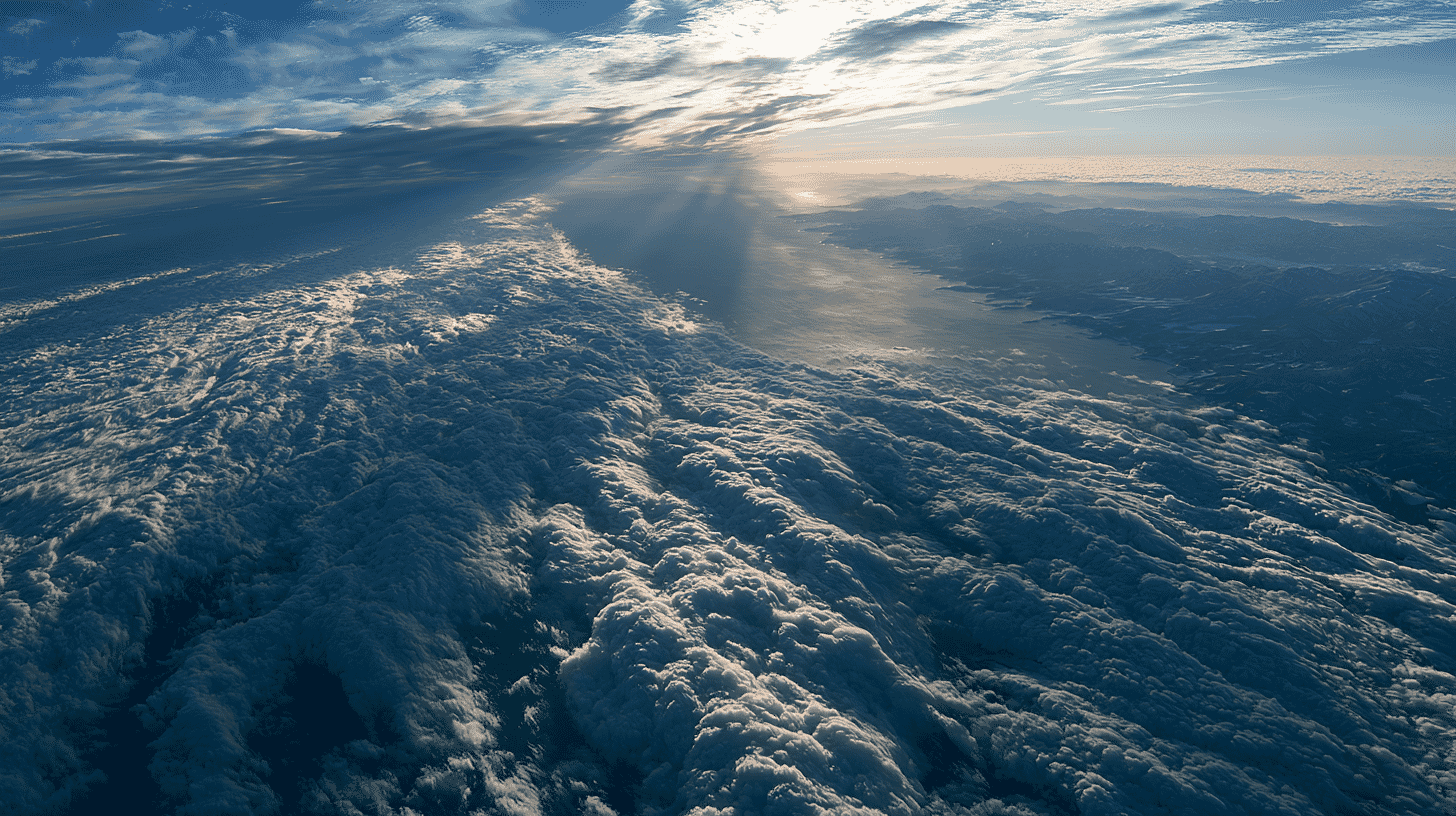
Cloud seeding has had roughly the same goal since the late 1940s: getting more water out of the sky. A Japanese national research project is trying to run the idea backwards, and in December it starts flying dry ice over the Sea of Japan to find out whether that is even measurable. Its own log of the trial run, published this month, records an experiment that mostly did not work.
Seeding a cloud so it rains somewhere else
Seeding means giving a cloud something to freeze onto. Scatter enough particles at the right altitude and supercooled water turns to ice, the ice grows, and it falls. That is how more than 50 countries currently run operational programmes to enhance rain and snow, disperse fog or suppress hail, according to the World Meteorological Organization.
The project, managed by Chiba University professor Shunji Kotsuki, is called AMAGOI, a forced acronym that is also the Japanese word for a rain prayer, and it sits inside the Cabinet Office's Moonshot programme under a target of controlling typhoons and torrential rain by 2050.
The plan has two halves. Generate rain offshore, upstream, so the air mass arrives over land with less water vapour in it. And where a storm cloud is already growing, flood it with so many seed particles that the moisture is divided among too many ice crystals for any raindrop to grow properly. That second effect has a name: overseeding.
In March this year the team published what the physics looks like in a simulation. Using a supercomputer to rebuild the August 2014 Hiroshima downpour, a joint team led by Yusuke Hiraga at Tohoku University seeded the model storm at various heights. Seeding widely at about seven to eight kilometres above the ground worked best, cutting three-hour rainfall over the worst-hit area by 11.5 percent on average and 32 percent at maximum. All the dry ice it would take fits inside one small business jet.
The rain did not vanish. It was pushed downwind.
What they will actually seed in December is snow
The disaster this project is ultimately aimed at is torrential summer rain, but that is not what gets seeded this December. The slides Kazuaki Yasunaga of the University of Toyama presented at the public briefing in Toyama on September 11 name the target precisely: snow clouds developing over Toyama Bay in winter.
Summer cumulonimbus tower so high that reaching them needs a jet, which is expensive, and they are both hard to forecast and rare. Winter sea-effect snow clouds off the Sea of Japan coast sit low enough for a propeller aircraft, form predictably, and form constantly. Of everywhere along that coast, Toyama is where those conditions line up most reliably.
Yasunaga's slides do not make this argument, but the science points the same way. Wintertime seeding of orographic clouds is the case the WMO singles out as having begun to show an evidence-based causal link, precisely because those clouds behave in constrained, repeatable ways.
The scale is deliberately small. Releases are planned for roughly six to eight days between December 1, 2026 and March 31, 2027. Up to 30 kilograms of dry ice per release, up to three releases a day, up to ten minutes each. They do not fly while a heavy snow warning is in force. Whatever energy this adds to the atmosphere, the team tells residents, is less than one millionth of what nature is already supplying.
The January log is a record of not seeing anything
National research on seeding snow clouds and on rainmaking for drought relief has run on and off in Japan since 1988. What is new is that this project publishes its flight notes.
Between January 6 and 15 this year the team flew four seeding days out of Nagoya Airport. On January 10, four offshore clouds were seeded: the clouds changed, but whether that was the seeding could not be significantly confirmed from the aircraft. January 12, two passes over a rain band: a quick look at radar and at the Himawari satellite showed no significant meteorological change. January 13, 30 kilograms released over the middle of Toyama Bay at 8,500 feet: no visible effect at all. Only the January 7 run over land produced something clean, a small cloud that appeared, was picked up by a ground-based lidar, and dissolved within minutes.
The September slides summarise all of it in one line: neither the offshore nor the onshore trials produced any clear change reaching the ground, exactly as predicted.
You cannot measure the rain that did not fall. The WMO's own position paper says as much: projects rarely manage to show, with any real confidence, that they hit the target they set. The more complicated a cloud's dynamics, the more thoroughly natural variability swamps whatever the seeding did. A bill analysis prepared for the Florida Senate, summarising a federal audit of the research, puts the extra precipitation from cold-season seeding at anywhere from zero to 20 percent.
This winter's round is aimed at measurement rather than snow. Instruments at the Sonoeyama campground in Nyuzen are being upgraded, a new X-band multi-parameter weather radar is going into Himi, and drones will fly. The goal is to catch a change too small for anyone standing outside to notice.
Somebody has to catch the rain you moved
Japan has reason to want this to work. The number of three-hour bursts of 150 millimetres or more, one of the thresholds behind the alert Japan issues when a torrential rain band forms, has gone from about 19 a year in 1976 to 1985 to about 33 in the decade to 2024. Flood damage in 2019 came to roughly 2.18 trillion yen, about $13.8 billion at the September 2026 rate of 157.5 yen to the dollar, the worst since the statistics began in 1961. Even so, the team estimates that only about four heavy-rain events a year across seven prefectures in Kyushu plus Yamaguchi would be candidates for intervention at all.
Moving rain is not the same as removing it, and the project's legal researchers have been working on the consequences in parallel. Under current Japanese law, the Japan Coast Guard is a leading candidate for who would actually carry out offshore rain control, on the strength of its existing disaster-relief mandate. Existing state compensation would not cover the damage adequately, since one branch requires official negligence and the other is unlikely to treat weather-control losses as the kind of special sacrifice it was built for. A new scheme is therefore hard to avoid, and the model the researchers have turned to is the Space Activities Act, which puts no-fault and unlimited liability on launch operators.
The same group lists, among the reasons written rules are needed at all, keeping regional and international risks from materialising. The WMO likewise notes that unintended downwind effects have been suggested in studies and need further investigation.
Japanese opinion, meanwhile, is mostly not formed yet. In a survey of about 3,000 adults, only around 20 percent said they knew anything about weather control technology, while about 40 percent said it was already important, with people who had lived through a disaster more likely to say so.
One state bans it, one country begins it
Outside Japan the same technology is moving in two directions at once. Florida, whose legislature compiled that range, went on to ban the practice: a law in force since July 1, 2025 prohibits acts intended to affect temperature, weather or the intensity of sunlight, sweeping up both solar geoengineering and ordinary cloud seeding. Tennessee had done the same the year before. That analysis also records seeding programmes running in at least nine states as of July 2024. The treaty usually cited here, the Environmental Modification Convention, entered into force in 1978 and now has 78 states parties, and what it bans is hostile use. Weather modification for peaceful purposes sits outside it.
Japan is not about to control the weather. A team in Toyama is trying to establish whether a very small nudge to a snow cloud can be shown to have done anything at all, and it is publishing the nights that failed. Is anyone seeding clouds where you live? Would you expect to be told if they were?
References
- https://www.jst.go.jp/moonshot/program/goal8/89_kotsuki.html
- https://beyond-predictions.com/moonshot/field-experiments/
- https://beyond-predictions.com/wp-content/uploads/2026/09/shiryo_20260911.pdf
- https://www.jst.go.jp/moonshot/program/goal8/files/89_kotsuki_report2025.pdf
- https://www.tohoku.ac.jp/japanese/2026/03/press20260318-04-seeding.html
- https://nhess.copernicus.org/articles/26/1287/2026/
- https://wmo.int/content/wmo-statement-weather-modification
- https://www.flsenate.gov/Session/Bill/2025/56/Analyses/2025s00056.pre.en.PDF
- https://www.data.jma.go.jp/cpdinfo/ccj/2025/html_honpen/cc2025_honpen_5.html
- https://www.mlit.go.jp/report/press/mizukokudo03_hh_001056.html
- https://www.epa.gov/geoengineering/frequent-questions
- https://disarmament.unoda.org/en/our-work/weapons-mass-destruction/convention-prohibition-military-or-any-other-hostile-use-environmental-modification-techniques





Global Discussion
4 comments