🦖 More than 11,000 kilometers from Mexico's Yucatan Peninsula, in a forested valley in eastern Hokkaido, a black band of clay five to ten centimeters thick runs along the bed of a stream most maps don't bother to label.
It is the only place in East Asia where you can walk up and touch the moment the dinosaurs died.
On May 19, 2026, however, a team led by Tohoku University reported that the outcrop everyone has been visiting for forty years is not the boundary at all. The real one, they say, sits about four kilometers to the northeast, in a different stream.
The thinnest line in Earth's history
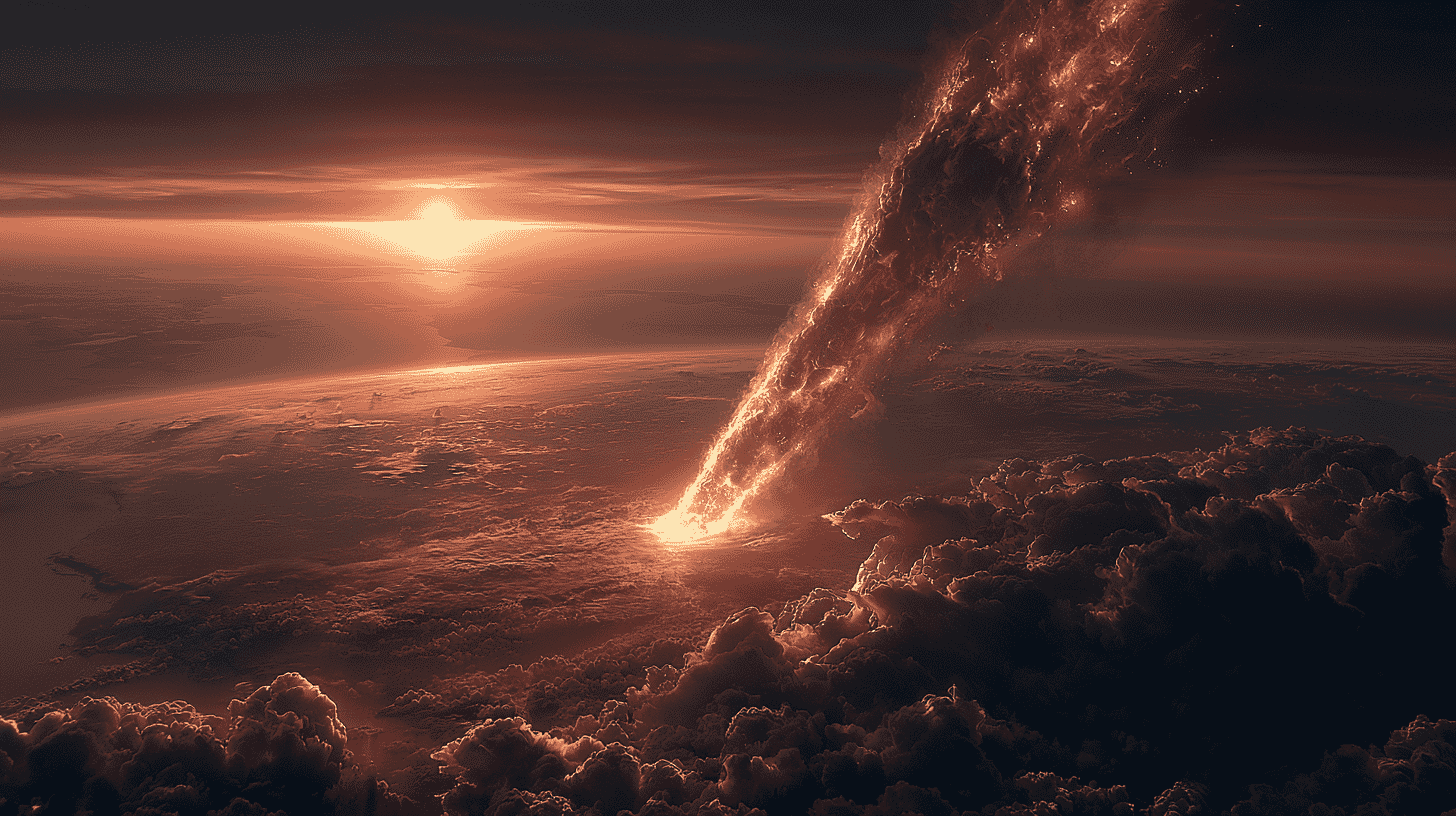
The boundary geologists call the K-Pg (short for the Cretaceous and Paleogene periods) is a globally distributed clay layer marking the moment, around 66 million years ago, when an asteroid roughly ten kilometers across slammed into what is now the Gulf of Mexico. The collision wiped out about three-quarters of all species, including non-avian dinosaurs, ammonites, and most large marine reptiles.
The fingerprint that gives the layer away is iridium. The metal is vanishingly rare in Earth's crust but hundreds to thousands of times more abundant in meteorites. When Luis and Walter Alvarez and their colleagues reported in 1980 that the K-Pg clay around the world contained anomalous iridium concentrations, it transformed the impact hypothesis from speculation into mainstream science.
The K-Pg layer has been logged at more than 350 sites worldwide. But across all of East Asia, only one municipality lets you find it at the surface and put your finger on it: Urahoro, in eastern Hokkaido. In 1986, Yamagata University researchers Kunio Kaiho and Tsunemasa Saito identified a black clay layer in the Nemuro Group along the Mokawaruppu stream as the boundary, based on the planktonic foraminifera in the beds above and below it. For forty years that outcrop stood as East Asia's only K-Pg boundary.
The identification, though, had a gap in it. Nobody had measured the iridium content or the osmium isotope ratio of the clay itself, and the rock fabric and local structure raised the possibility that the outcrop was a fault breccia rather than an intact sedimentary record.
A black line you have to dig for
The long-accepted outcrop sits inside a prefectural forest reserve, accessible only with permission from the forestry office. Reaching it means a roughly hour-long drive from Urahoro town along the Kawaruppu river and its smaller branch, the Mokawaruppu, names that, like much of the region's geography, come from Ainu words for the local landscape.
Every winter, sediment carried from upstream buries the boundary. So every spring, the first visitors of the season, sometimes geology students from Hokkaido University, sometimes a curator from the local museum, start the season by scraping away the silt with a shovel and rinsing the bank with stream water hauled in a plastic bucket.
What finally emerges is a band of black clay about five centimeters thick, sandwiched between unremarkable gray siltstone. There is no dramatic color contrast in the surrounding rock. To the untrained eye, it looks like a slightly darker stripe of gravel. It is also one of the most consequential thin lines on Earth.
The geology downstream of that black band records the warm Cretaceous seas where dinosaurs still roamed the nearby continent. Upstream, the rock belongs to the new Cenozoic era, a world of mammals on the rise and ammonites already gone. A peel sample lifted from this outcrop is on display at the Ashoro Museum of Paleontology, and generations of students have been brought here.
How a Mexican impact ended up in a Hokkaido stream
The Chicxulub crater, buried under sediments off the Yucatan Peninsula, stretches roughly 200 kilometers across. At the time of the impact, eastern Hokkaido was not yet attached to its current position; it sat on the northwestern edge of the Pacific, just off the Asian continent. Even so, the distance to the impact point was already more than 10,000 kilometers, and the debris still reached it.
The explanation lies in the size and physics of the impact. Iridium-rich dust was launched into the upper atmosphere, where it stayed aloft long enough to circle the planet many times. Estimates suggest that the global blanket of impact-derived material took years, perhaps decades, to settle out completely. By the time it did, every continent and seafloor on Earth had received a faint dusting.
In 2021, an international team including researchers from what was then Tokyo Institute of Technology (now Science Tokyo), the University of Tokyo, and JAMSTEC reported iridium concentrated at the very top of the impact-related sediments inside Chicxulub itself. The presence of iridium inside the crater allows scientists to align the timeline at the impact site with the K-Pg boundary clays found around the world.
Urahoro provides the mirror image of that result. Where Chicxulub records the moment closest to the impact, Urahoro records what happened more than 10,000 kilometers away: a far-field test of how the global dust layer was distributed.
Tohoku University's answer: four kilometers northeast
A joint team centered on Professor Reishi Takashima of the Tohoku University Museum, with colleagues from the University of Tokyo, Fukui Prefectural University, Hokkaido University and Aichi University of Education, has spent more than a decade, since 2013, hunting the K-Pg boundary through the Nemuro Group. They sampled at roughly 25-centimeter intervals and cross-checked osmium isotope ratios, microfossils, radiometric ages from volcanic ash, and paleomagnetism.
Their conclusion appeared in Communications Earth & Environment on May 19, 2026. The Mokawaruppu outcrop showed neither an iridium enrichment nor an osmium isotope anomaly. The diagnostic signals instead lined up in a mudstone unit in the upper reaches of a tributary of the Kawaruppu river, about four kilometers to the northeast.
Osmium is a platinum-group element abundant in meteorites, and it carries a lower 187Os/188Os ratio than continental crust. A sharp drop in that ratio, together with an iridium spike, has long been the primary test for a K-Pg boundary. The newly identified beds pass it, and, crucially, they were not scoured by impact tsunami: the team says the record may be continuous enough to resolve environmental change on a scale of centuries.
An interim report from the group's 2021 grant project also dated zircon crystals from a tuff just above the boundary at 65.44 ± 0.89 million years by uranium-lead methods, statistically indistinguishable from the globally accepted K-Pg age of around 66.05 million years.
Why East Asia only has one
Surface exposures of the K-Pg boundary are surprisingly rare worldwide. The famous outcrops cluster in western North America, northern Europe, the Mediterranean, and the South Pacific. Across East Asia, most coastal environments of the late Cretaceous were too active: river sediment diluted the impact signal, washing out the iridium spike before it could accumulate cleanly.
Researchers at Kyushu University and elsewhere have pursued an alternative strategy, looking for the boundary in deep-sea pelagic chert deposited far from any continent. That work has identified multiple impact events in Japan's deep-time record. But for a section you can stand on and photograph, Urahoro is still the only game in town for East Asia.
What preserved a record here was a quiet stretch of continental margin: deep enough to escape constant fluvial flushing, shallow enough to hold marine microfossils that bracket the boundary. Marine sections elsewhere were gouged by impact tsunami and land sections are constantly eroding, which is why continuous records are so scarce. Continuity is exactly what makes the newly identified beds valuable.
A modest outcrop with a planetary story
In 2022 and again in autumn 2025, teams from the Hokkaido Museum produced "peel" samples of the long-accepted layer: thin, glue-lifted slices suitable for museum exhibition. The Urahoro Town Museum has since been explaining to visitors how the old and new outcrops relate to one another. None of this generates major headlines. But quietly, one of the rarest geological records on the planet is being properly catalogued.
There is something disorienting about standing next to a centimeter-thin layer of clay that marks the end of the dinosaur era. Most people learn about the K-Pg extinction through textbooks and museum dioramas, abstract and distant. The Urahoro outcrop turns that abstraction into a place. A black streak in a small stream. A thing you could miss if you weren't looking.
As work on the newly identified beds proceeds, it should tighten the picture of what happened in the northwest Pacific in the immediate aftermath of the impact: how marine plankton responded, how quickly seawater chemistry shifted, how soon life began to recover at this latitude. The next generation of dinosaur-extinction research is being written, in part, from rocks in a Hokkaido forest.
How far along is K-Pg boundary research in your country? Are there impact-extinction outcrops near where you live, or sites that have made it into geology textbooks? We'd love to hear what your local rocks remember.
References
- https://news.yahoo.co.jp/articles/1bb96de65b95ce4eb7dbc70a64eaa7e3a93feab9
- https://museum-urahoro.jp/2024/04/12/k-pg2024/
- https://museum-urahoro.jp/2023/06/12/k-pg/
- https://kaken.nii.ac.jp/ja/grant/KAKENHI-PROJECT-21H04503
- https://www.titech.ac.jp/news/2021/049044
- https://www.astroarts.co.jp/article/hl/a/11871_chicxulub
- https://www.r-info.tohoku.ac.jp/ja/974d4da6ab3ac13ba237ff6d9678be15.html
- http://www.geosites-hokkaido.org/geosites/site0213.html
- https://www.jstage.jst.go.jp/article/cadasu/7/0/7_13/_pdf/-char/ja
- https://www.sci.tohoku.ac.jp/news/20260520-14260.html (Tohoku University press release, May 20, 2026)
- https://www.hirosaki-u.ac.jp/topics/113995/ (Hirosaki University press release)
- https://urahoro-museum.note.jp/n/n99c6f1ec895f (Urahoro Town Museum on the newly identified boundary)





Global Discussion
4 comments